


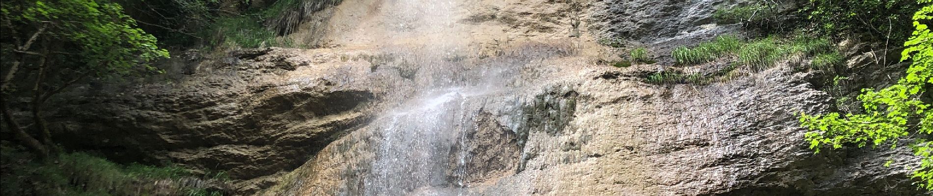
Cascades de l’Alloix Montalieu

alinetpierre
User
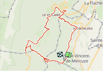

Length
13.6 km

Max alt
910 m

Uphill gradient
698 m
Km-Effort
23 km

Min alt
382 m

Downhill gradient
699 m
Boucle
Yes
Creation date :
2023-06-01 07:21:21.0
Updated on :
2023-06-01 13:23:05.801
3h52
Difficulty : Difficult

FREE GPS app for hiking
 SityTrail
IGN / Geographical institutes
SityTrail Plus
The world is yours!
About
Trail Walking of 13.6 km to be discovered at Auvergne-Rhône-Alpes, Isère, Saint-Vincent-de-Mercuze. This trail is proposed by alinetpierre.
Description
Très belle randonnée, belles cascades,
Photos


Positioning
Country:
France
Region :
Auvergne-Rhône-Alpes
Department/Province :
Isère
Municipality :
Saint-Vincent-de-Mercuze
Location:
Unknown
Start:(Dec)
Start:(UTM)
730484 ; 5028462 (31T) N.
Comments