


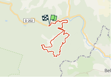
Autour de la chapelle de Montrieux

FSantoni
User

Length
10.1 km

Max alt
463 m

Uphill gradient
309 m
Km-Effort
14.2 km

Min alt
227 m

Downhill gradient
310 m
Boucle
Yes
Creation date :
2023-06-03 06:37:38.155
Updated on :
2023-06-03 15:21:08.233
3h13
Difficulty : Difficult

FREE GPS app for hiking
 SityTrail
IGN / Geographical institutes
SityTrail Plus
The world is yours!
About
Trail Walking of 10.1 km to be discovered at Provence-Alpes-Côte d'Azur, Var, Méounes-lès-Montrieux. This trail is proposed by FSantoni.
Description
Très agréable. Beaucoup de parties à l'ombre. Dénivelé doux.
Photos


Positioning
Country:
France
Region :
Provence-Alpes-Côte d'Azur
Department/Province :
Var
Municipality :
Méounes-lès-Montrieux
Location:
Unknown
Start:(Dec)
Start:(UTM)
740547 ; 4794382 (31T) N.
Comments