


Eau&Pierre Hastiere communale

pjjrevrard
User
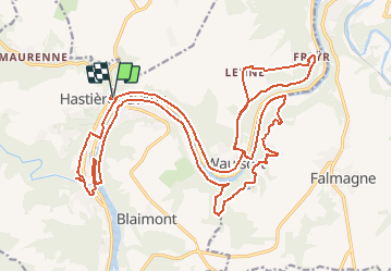

Length
29 km

Max alt
250 m

Uphill gradient
701 m
Km-Effort
39 km

Min alt
89 m

Downhill gradient
705 m
Boucle
Yes
Creation date :
2014-12-10 00:00:00.0
Updated on :
2014-12-10 00:00:00.0
8h11
Difficulty : Difficult

FREE GPS app for hiking
 SityTrail
IGN / Geographical institutes
SityTrail Plus
The world is yours!
About
Trail Walking of 29 km to be discovered at Wallonia, Namur, Hastière. This trail is proposed by pjjrevrard.


Positioning
Country:
Belgium
Region :
Wallonia
Department/Province :
Namur
Municipality :
Hastière
Location:
Hastière-Lavaux
Start:(Dec)
Start:(UTM)
630180 ; 5564307 (31U) N.
Comments