


chapelle St Joseph en AR

CABERMAT
User
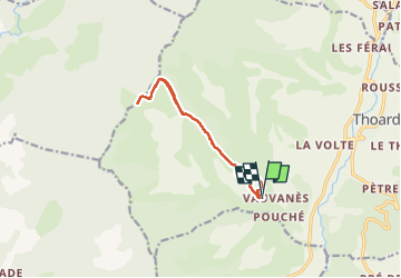

Length
11.4 km

Max alt
1311 m

Uphill gradient
570 m
Km-Effort
19 km

Min alt
832 m

Downhill gradient
566 m
Boucle
Yes
Creation date :
2023-06-05 06:51:48.603
Updated on :
2023-06-05 12:16:31.415
5h23
Difficulty : Very difficult

FREE GPS app for hiking
 SityTrail
IGN / Geographical institutes
SityTrail Plus
The world is yours!
About
Trail Walking of 11.4 km to be discovered at Provence-Alpes-Côte d'Azur, Alpes-de-Haute-Provence, Thoard. This trail is proposed by CABERMAT.
Positioning
Country:
France
Region :
Provence-Alpes-Côte d'Azur
Department/Province :
Alpes-de-Haute-Provence
Municipality :
Thoard
Location:
Unknown
Start:(Dec)
Start:(UTM)
268995 ; 4890634 (32T) N.
Comments