


autour de Morillon 74 .

José800
User
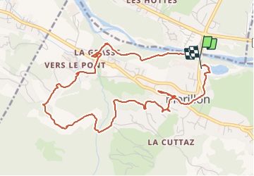

Length
5.9 km

Max alt
791 m

Uphill gradient
152 m
Km-Effort
7.9 km

Min alt
657 m

Downhill gradient
154 m
Boucle
Yes
Creation date :
2023-06-05 10:38:32.371
Updated on :
2023-06-05 15:04:40.31
1h51
Difficulty : Easy

FREE GPS app for hiking
 SityTrail
IGN / Geographical institutes
SityTrail Plus
The world is yours!
About
Trail Walking of 5.9 km to be discovered at Auvergne-Rhône-Alpes, Upper Savoy, Morillon. This trail is proposed by José800.
Description
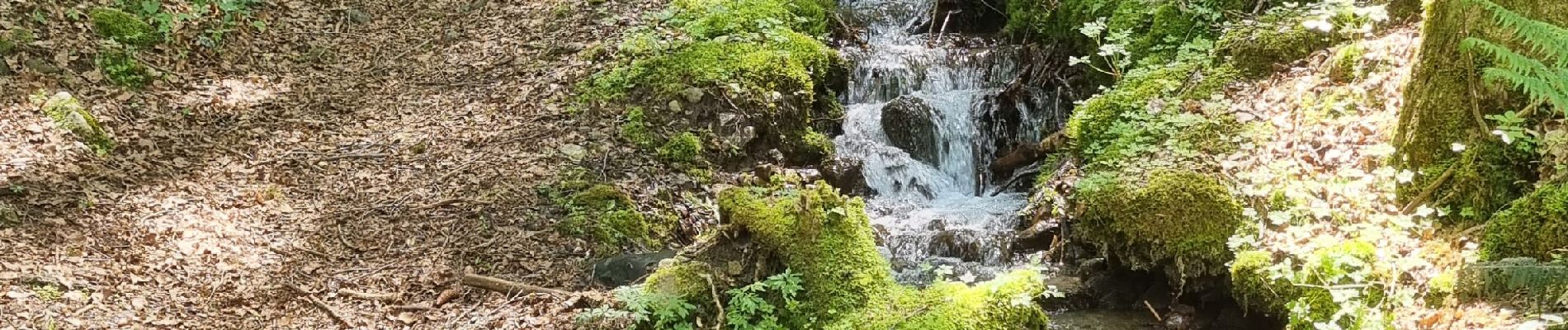
un beau circuit avec des beaux villages ,forêt , lac et petits torrents
Photos


Positioning
Country:
France
Region :
Auvergne-Rhône-Alpes
Department/Province :
Upper Savoy
Municipality :
Morillon
Location:
Unknown
Start:(Dec)
Start:(UTM)
320542 ; 5106359 (32T) N.
Comments