Trail Walking Guimaëc - Gr34 Poul Rodou à Venizella - Photo

Gr34 Poul Rodou à Venizella

© OpenStreetMap contributors
Length
Length
3.3 km
Max alt
Max alt
46 m
Uphill gradient
Uphill gradient
74 m
Km-Effort
Km-Effort  
4.3 km
Min alt
Min alt
4 m
Downhill gradient
Downhill gradient
76 m
Boucle
Boucle
No
Creation date :
2023-06-14 07:38:45.581
Updated on :
2023-06-21 16:07:59.709

(0 Reviews)

Walking
Walking
55m
Difficulty : Easy

Scan this QR Code to open this trail in the SityTrail application

FREE GPS app for hiking

Logo SityTrail SityTrail

IGN / Geographical institutes

Download SityTrail from the App Store Download SityTrail from Google Play

Logo SityTrail SityTrail World

The world is yours!

Download SityTrail from the App Store Download SityTrail from Google Play Download SityTrail on Huawei AppGallery

About

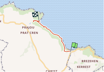
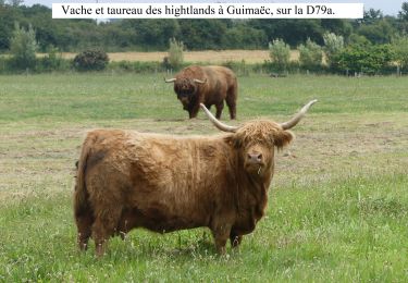
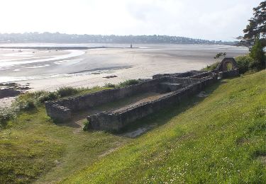
Trail Walking of 3.3 km to be discovered at Brittany, Finistère, Guimaëc. This trail is proposed by Corto2023.

Description

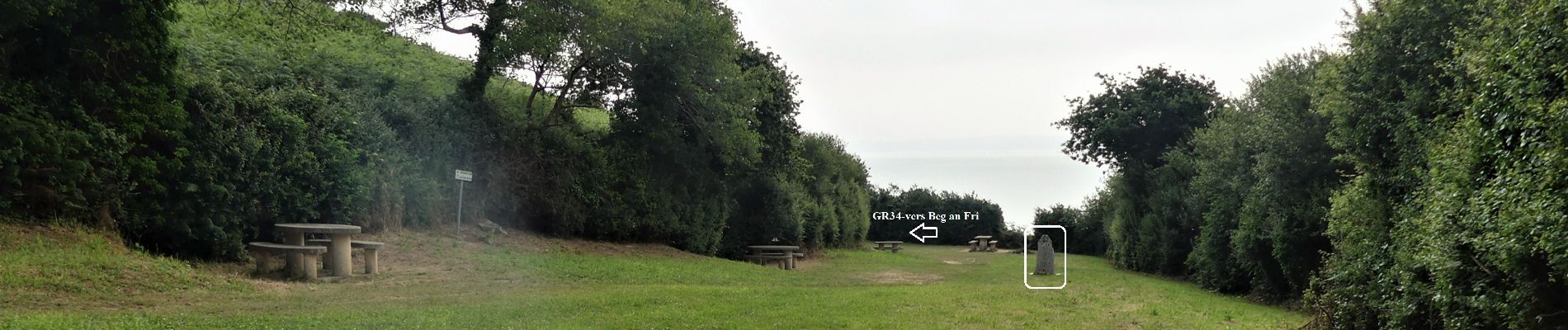
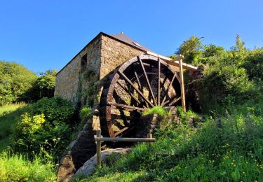
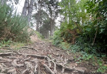
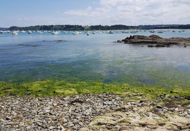
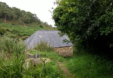
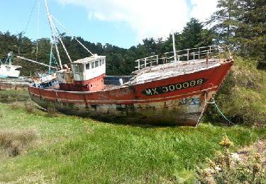
Sur cette portion très courte (55mn) c’est un sentier tranquille et très bien entretenu (à partir de la mi-juin). On longe la mer sans aucune difficulté. Belles perspectives sur les trois plages de Poul Rodou, Sainte Rose et Velin Izella (ou Venizella c'est selon), séparées par des pointes rocheuses. Départ du café-librairie (joli concept) CAPLAN&CO près de la plage de Poul Rodou. Arrivée sur le parking de la plage de Venizella. Prenez le temps de remonter la route sur 170 m pour voir le moulin à aubes de Trobodec. Sachez que "Venizella" peut s'entendre comme de l'italien, mais c'est du breton : "le moulin" ("ven") ; "en bas" ("izel" ou "izella"). On redescend sur l'aire de pique-nique pour voir la stèle du réseau VAR qui permet à François Mitterrand, alias Morland, chef du mouvement de résistance MNPRG de revenir en France en débarquant ici le 27 février 1944. Au bout de l'aire de pique-nique on entame à gauche une nouvelle portion du GR34 qui monte sur la pointe Beg an Fri et arrive (7km) à la plage de St Jean du doigt : voir cette rando. (attention tiques) Bonne route !

Elevation profile

Photos

Positioning

Country:
France
Region :
Brittany
Department/Province :
Finistère
Municipality :
Guimaëc
Location:
Unknown
Start:(UTM)
448470 ; 5393156 (30U) N.

Trails nearby

Trail Nordic walking Guimaëc - guimaec loquirec - Photo
Nordic walking
elianette

Nordic walking

Very easy
(1)
Guimaëc, Brittany, Finistère, France
8.7 km | 11.2 km-effort
2h 30min
No
Trail Walking Guimaëc - GR 34 de Velizella à plage de St Jean du doigt - Photo
Walking
Corto2023

Walking

Medium
Guimaëc, Brittany, Finistère, France
7.2 km | 11.5 km-effort
2h 51min
No
Trail Walking Guimaëc - Bretagne nord j6  am : De Guimaec à Locquirec - Photo
Walking
chessyca

Walking

Very easy
Guimaëc, Brittany, Finistère, France
10.5 km | 13.2 km-effort
3h 14min
No
Trail Walking Locquirec - lokirec - Photo
Walking

Walking

Very easy
Locquirec, Brittany, Finistère, France
4.6 km | 5.7 km-effort
1h 12min
Yes
Trail Walking Guimaëc - Circuit de Beg An Fry - Photo
Walking
Dervalmarc

Walking

Medium
Guimaëc, Brittany, Finistère, France
8.2 km | 11.5 km-effort
3h 18min
Yes
Trail Walking Guimaëc - GR 34 étape 22 - Photo
Walking
lagardienne

Walking

Medium
Guimaëc, Brittany, Finistère, France
27 km | 36 km-effort
8h 37min
No
Trail Walking Plestin-les-Grèves - Embouchure du Douron - Plestin Les Grèves - Photo
Walking
tracegps

Walking

Medium
Plestin-les-Grèves, Brittany, Côtes-d'Armor, France
10.7 km | 12.9 km-effort
3h 0min
Yes
Trail Walking Plestin-les-Grèves - De Plestin Les Grèves à Saint Efflam - Photo
Walking
tracegps

Walking

Medium
(1)
Plestin-les-Grèves, Brittany, Côtes-d'Armor, France
10.7 km | 13.4 km-effort
4h 0min
Yes
Trail Walking Locquirec - locquirec - Photo
Walking
COMAN

Walking

Very easy
Locquirec, Brittany, Finistère, France
7.2 km | 8.9 km-effort
1h 59min
Yes


Close
My subscriptions