


Clecy

jacqueline L
User
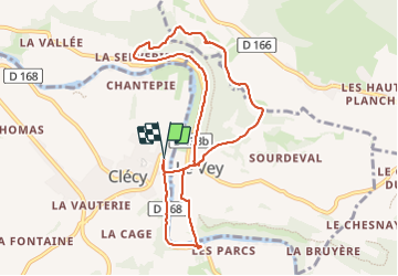

Length
9.2 km

Max alt
248 m

Uphill gradient
317 m
Km-Effort
13.4 km

Min alt
32 m

Downhill gradient
320 m
Boucle
Yes
Creation date :
2023-06-15 07:02:08.0
Updated on :
2023-06-15 10:51:27.96
3h47
Difficulty : Difficult

FREE GPS app for hiking
 SityTrail
IGN / Geographical institutes
SityTrail Plus
The world is yours!
About
Trail Walking of 9.2 km to be discovered at Normandy, Calvados, Clécy. This trail is proposed by jacqueline L.
Positioning
Country:
France
Region :
Normandy
Department/Province :
Calvados
Municipality :
Clécy
Location:
Unknown
Start:(Dec)
Start:(UTM)
684869 ; 5421404 (30U) N.
Comments