


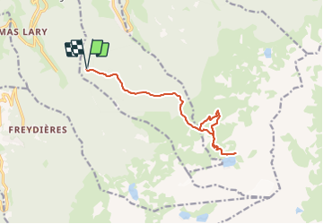
Belledonne - Lac Blanc

gregou74
User

Length
15.2 km

Max alt
2210 m

Uphill gradient
1177 m
Km-Effort
31 km

Min alt
1190 m

Downhill gradient
1177 m
Boucle
Yes
Creation date :
2023-06-16 09:43:18.178
Updated on :
2023-06-16 09:52:40.844
7h01
Difficulty : Very difficult

FREE GPS app for hiking
 SityTrail
IGN / Geographical institutes
SityTrail Plus
The world is yours!
About
Trail Walking of 15.2 km to be discovered at Auvergne-Rhône-Alpes, Isère, Saint-Mury-Monteymond. This trail is proposed by gregou74.
Description
Départ : Abris Forestier de Pré Long
Positioning
Country:
France
Region :
Auvergne-Rhône-Alpes
Department/Province :
Isère
Municipality :
Saint-Mury-Monteymond
Location:
Unknown
Start:(Dec)
Start:(UTM)
729176 ; 5009691 (31T) N.
Comments