


Establet

alinetpierre
User
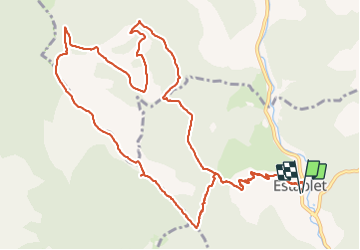

Length
15.3 km

Max alt
1391 m

Uphill gradient
656 m
Km-Effort
24 km

Min alt
768 m

Downhill gradient
654 m
Boucle
Yes
Creation date :
2023-06-16 07:25:03.0
Updated on :
2023-07-08 07:55:26.83
4h31
Difficulty : Easy

FREE GPS app for hiking
 SityTrail
IGN / Geographical institutes
SityTrail Plus
The world is yours!
About
Trail Walking of 15.3 km to be discovered at Auvergne-Rhône-Alpes, Drôme, Establet. This trail is proposed by alinetpierre.
Description
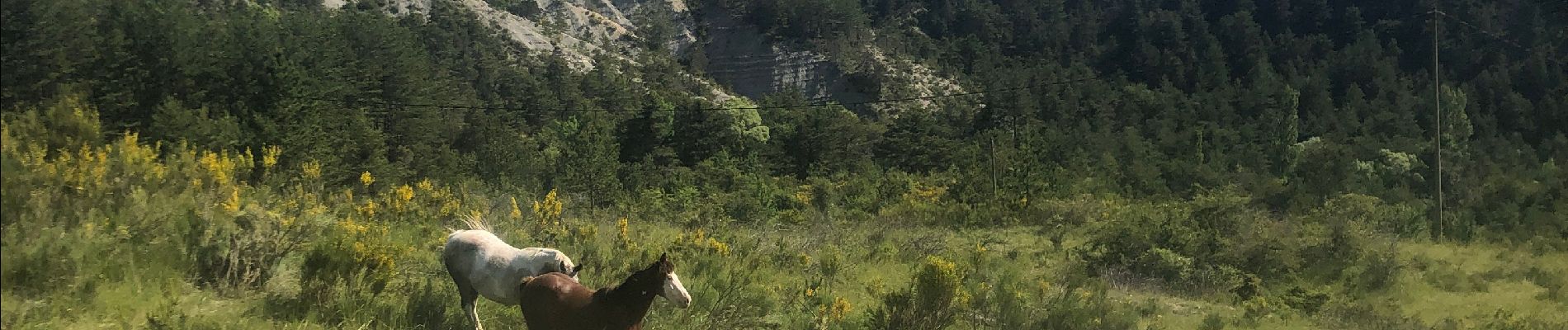
Belle randonnée pleine de fleurs
Photos


Positioning
Country:
France
Region :
Auvergne-Rhône-Alpes
Department/Province :
Drôme
Municipality :
Establet
Location:
Unknown
Start:(Dec)
Start:(UTM)
693818 ; 4930962 (31T) N.
Comments