


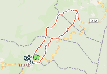
Le Faz- la Lunette - Le Faz

CABERMAT
User

Length
9.6 km

Max alt
1322 m

Uphill gradient
388 m
Km-Effort
14.8 km

Min alt
1007 m

Downhill gradient
388 m
Boucle
Yes
Creation date :
2023-06-17 07:58:26.787
Updated on :
2023-06-17 11:52:25.608
3h53
Difficulty : Difficult

FREE GPS app for hiking
 SityTrail
IGN / Geographical institutes
SityTrail Plus
The world is yours!
About
Trail Walking of 9.6 km to be discovered at Auvergne-Rhône-Alpes, Isère, Presles. This trail is proposed by CABERMAT.
Positioning
Country:
France
Region :
Auvergne-Rhône-Alpes
Department/Province :
Isère
Municipality :
Presles
Location:
Unknown
Start:(Dec)
Start:(UTM)
689117 ; 4998683 (31T) N.
Comments