


pommeuse

mimimartine
User
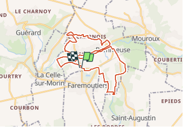

Length
18.8 km

Max alt
130 m

Uphill gradient
268 m
Km-Effort
22 km

Min alt
58 m

Downhill gradient
267 m
Boucle
Yes
Creation date :
2023-06-17 14:51:21.618
Updated on :
2023-06-17 14:51:56.846
5h05
Difficulty : Medium

FREE GPS app for hiking
 SityTrail
IGN / Geographical institutes
SityTrail Plus
The world is yours!
About
Trail On foot of 18.8 km to be discovered at Ile-de-France, Seine-et-Marne, Pommeuse. This trail is proposed by mimimartine.
Positioning
Country:
France
Region :
Ile-de-France
Department/Province :
Seine-et-Marne
Municipality :
Pommeuse
Location:
Unknown
Start:(Dec)
Start:(UTM)
499569 ; 5406119 (31U) N.
Comments