


Rustrel

Paul Chocotat
User
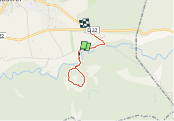

Length
2 km

Max alt
378 m

Uphill gradient
30 m
Km-Effort
2.3 km

Min alt
353 m

Downhill gradient
12 m
Boucle
No
Creation date :
2023-06-18 09:19:14.484
Updated on :
2023-06-18 09:59:39.96
37m
Difficulty : Easy

FREE GPS app for hiking
 SityTrail
IGN / Geographical institutes
SityTrail Plus
The world is yours!
About
Trail Walking of 2 km to be discovered at Provence-Alpes-Côte d'Azur, Vaucluse, Rustrel. This trail is proposed by Paul Chocotat.
Description
Colorado, circuit Sahara
Positioning
Country:
France
Region :
Provence-Alpes-Côte d'Azur
Department/Province :
Vaucluse
Municipality :
Rustrel
Location:
Unknown
Start:(Dec)
Start:(UTM)
700466 ; 4865662 (31T) N.
Comments