


Ens Walk

jpcccb
User
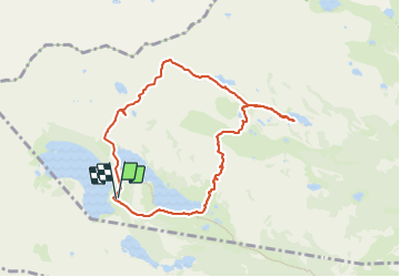

Length
8.8 km

Max alt
2499 m

Uphill gradient
485 m
Km-Effort
15.3 km

Min alt
2157 m

Downhill gradient
488 m
Boucle
Yes
Creation date :
2023-06-19 11:02:16.241
Updated on :
2023-06-19 13:51:26.94
3h28
Difficulty : Difficult

FREE GPS app for hiking
 SityTrail
IGN / Geographical institutes
SityTrail Plus
The world is yours!
About
Trail Walking of 8.8 km to be discovered at Occitania, Hautespyrenees, Vielle-Aure. This trail is proposed by jpcccb.
Positioning
Country:
France
Region :
Occitania
Department/Province :
Hautespyrenees
Municipality :
Vielle-Aure
Location:
Unknown
Start:(Dec)
Start:(UTM)
266610 ; 4747070 (31T) N.
Comments