


Ens Walk

jpcccb
User
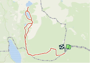

Length
12.1 km

Max alt
2272 m

Uphill gradient
362 m
Km-Effort
16.9 km

Min alt
2109 m

Downhill gradient
362 m
Boucle
Yes
Creation date :
2023-06-19 11:02:38.13
Updated on :
2023-06-19 13:52:09.787
3h50
Difficulty : Difficult

FREE GPS app for hiking
 SityTrail
IGN / Geographical institutes
SityTrail Plus
The world is yours!
About
Trail Walking of 12.1 km to be discovered at Occitania, Hautespyrenees, Saint-Lary-Soulan. This trail is proposed by jpcccb.
Positioning
Country:
France
Region :
Occitania
Department/Province :
Hautespyrenees
Municipality :
Saint-Lary-Soulan
Location:
Unknown
Start:(Dec)
Start:(UTM)
274066 ; 4745953 (31T) N.
Comments