Trail Walking Chanteuges - /43/Chanteuges/Source de Pourcheresse - Photo

/43/Chanteuges/Source de Pourcheresse

© OpenStreetMap contributors
Length
Length
3.6 km
Max alt
Max alt
655 m
Uphill gradient
Uphill gradient
141 m
Km-Effort
Km-Effort  
5.5 km
Min alt
Min alt
541 m
Downhill gradient
Downhill gradient
139 m
Boucle
Boucle
Yes
Creation date :
2023-06-19 15:04:48.805
Updated on :
2023-06-19 15:09:40.478

(0 Reviews)

Walking
Walking
1h14
Difficulty : Easy

Scan this QR Code to open this trail in the SityTrail application

FREE GPS app for hiking

Logo SityTrail SityTrail

IGN / Geographical institutes

Download SityTrail from the App Store Download SityTrail from Google Play

Logo SityTrail SityTrail World

The world is yours!

Download SityTrail from the App Store Download SityTrail from Google Play Download SityTrail on Huawei AppGallery

About

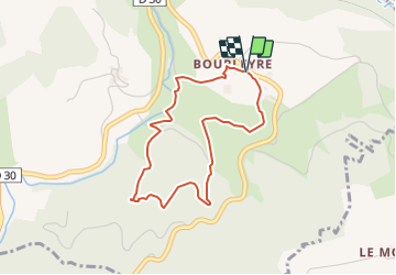
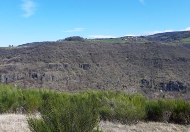
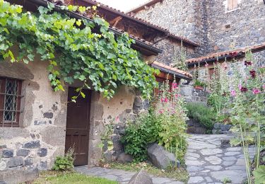
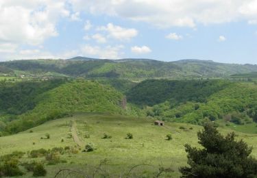
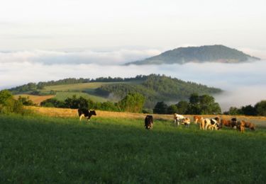
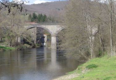
Trail Walking of 3.6 km to be discovered at Auvergne-Rhône-Alpes, Haute-Loire, Chanteuges. This trail is proposed by patrando49.

Description

Départ de Bourleyre sur la commune de Chanteuges - Balisage Jaune

Elevation profile

Positioning

Country:
France
Region :
Auvergne-Rhône-Alpes
Department/Province :
Haute-Loire
Municipality :
Chanteuges
Location:
Unknown
Start:(UTM)
543634 ; 4989736 (31T) N.

Trails nearby

Trail Walking Charraix - CHARRAIX ,NOTRE DAME D ESTOUR - Photo
Walking
FLORENSAC

Walking

Difficult
Charraix, Auvergne-Rhône-Alpes, Haute-Loire, France
17.8 km | 27 km-effort
7h 34min
Yes
Trail Electric bike Chanteuges - 43 Chanteuges,  gorges de l Allier, Siaugues Ste Marie, Langeac,  - Photo
Electric bike
chris13370

Electric bike

Difficult
Chanteuges, Auvergne-Rhône-Alpes, Haute-Loire, France
55 km | 68 km-effort
6h 38min
Yes
Trail Mountain bike Langeac - La croix de fer - Photo
Mountain bike
AMBLARD

Mountain bike

Very difficult
(1)
Langeac, Auvergne-Rhône-Alpes, Haute-Loire, France
15.6 km | 20 km-effort
3h 23min
Yes
Trail Cycle Saint-Arcons-d'Allier - Prades - Allier - Photo
Cycle
cathyetyves

Cycle

Very easy
(1)
Saint-Arcons-d'Allier, Auvergne-Rhône-Alpes, Haute-Loire, France
14.3 km | 17 km-effort
30min
Yes
Trail Walking Prades - De Prades à Notre Dame Destours via Sainte Marie des Chazes - Photo
Walking
tracegps

Walking

Medium
Prades, Auvergne-Rhône-Alpes, Haute-Loire, France
17.7 km | 27 km-effort
6h 0min
Yes
Trail Mountain bike Langeac - Espace VTT FFC des Gorges de l'Allier - Circuit n°16 - Tour du Langeadois - Photo
Mountain bike
tracegps

Mountain bike

Very difficult
Langeac, Auvergne-Rhône-Alpes, Haute-Loire, France
145 km | 194 km-effort
15h 0min
Yes
Trail Mountain bike Chanteuges - Espace VTT FFC des Gorges de l'Allier - Circuit n°9 - Vallée de la Desges - Photo
Mountain bike
tracegps

Mountain bike

Difficult
Chanteuges, Auvergne-Rhône-Alpes, Haute-Loire, France
32 km | 47 km-effort
3h 0min
Yes
Trail Mountain bike Langeac - Espace VTT FFC des Gorges de l'Allier - Circuit n°8 - Les deux Rives de l'Allier - Photo
Mountain bike
tracegps

Mountain bike

Medium
Langeac, Auvergne-Rhône-Alpes, Haute-Loire, France
13.6 km | 16.4 km-effort
1h 0min
Yes
Trail Motor Chanteuges - langeac.vichel - Photo
Motor
coppel

Motor

Difficult
Chanteuges, Auvergne-Rhône-Alpes, Haute-Loire, France
164 km | 223 km-effort
5h 35min
No


Close
My subscriptions