


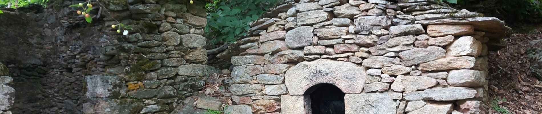
chapelle St Martin du froid

labarone
User
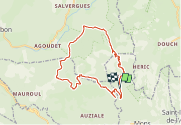

Length
20 km

Max alt
1074 m

Uphill gradient
846 m
Km-Effort
31 km

Min alt
437 m

Downhill gradient
848 m
Boucle
Yes
Creation date :
2023-06-20 07:15:18.569
Updated on :
2023-06-20 14:53:55.652
7h35
Difficulty : Medium

FREE GPS app for hiking
 SityTrail
IGN / Geographical institutes
SityTrail Plus
The world is yours!
About
Trail Walking of 20 km to be discovered at Occitania, Hérault, Mons. This trail is proposed by labarone.
Description
de beaux paysages à voir mais aujourd hui brumeux car risque de pluie qui n est pas tombée !
Photos


Positioning
Country:
France
Region :
Occitania
Department/Province :
Hérault
Municipality :
Mons
Location:
Unknown
Start:(Dec)
Start:(UTM)
495221 ; 4826164 (31T) N.
Comments