


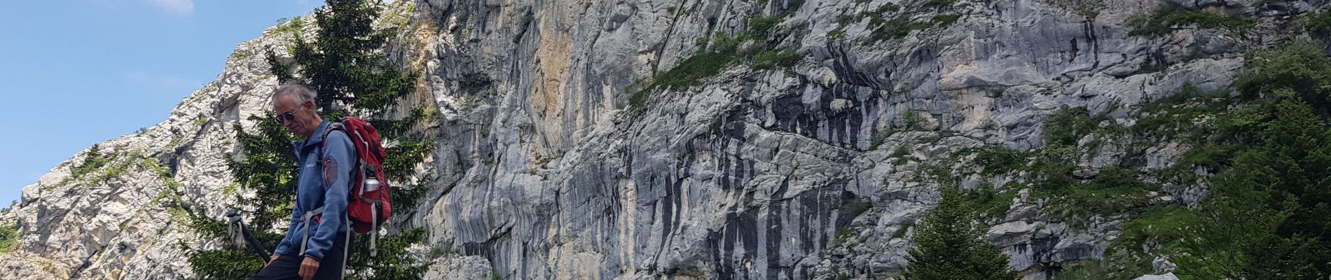
Pic st Michel

avdem
User

Length
12.5 km

Max alt
1965 m

Uphill gradient
650 m
Km-Effort
21 km

Min alt
1343 m

Downhill gradient
651 m
Boucle
Yes
Creation date :
2023-06-23 07:33:04.306
Updated on :
2023-06-23 14:13:03.31
6h38
Difficulty : Easy

FREE GPS app for hiking
 SityTrail
IGN / Geographical institutes
SityTrail Plus
The world is yours!
About
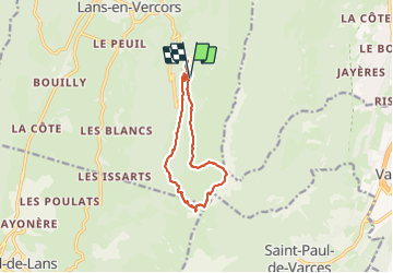
Trail Walking of 12.5 km to be discovered at Auvergne-Rhône-Alpes, Isère, Lans-en-Vercors. This trail is proposed by avdem.
Description
facile
Photos


21 photos in total. Please click on a photo to see them all in the gallery.
Positioning
Country:
France
Region :
Auvergne-Rhône-Alpes
Department/Province :
Isère
Municipality :
Lans-en-Vercors
Location:
Unknown
Start:(Dec)
Start:(UTM)
705193 ; 4998674 (31T) N.
Comments