


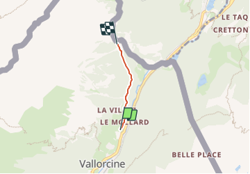
2023-06-24_12h45m46_sentier-de-la-cascade-de-barberine

Pascal Dirckx
User

Length
1.8 km

Max alt
1307 m

Uphill gradient
68 m
Km-Effort
2.5 km

Min alt
1247 m

Downhill gradient
17 m
Boucle
No
Creation date :
2023-06-24 10:45:46.601
Updated on :
2023-06-24 10:45:47.049

FREE GPS app for hiking
 SityTrail
IGN / Geographical institutes
SityTrail Plus
The world is yours!
About
Trail of 1.8 km to be discovered at Auvergne-Rhône-Alpes, Upper Savoy, Vallorcine. This trail is proposed by Pascal Dirckx.
Positioning
Country:
France
Region :
Auvergne-Rhône-Alpes
Department/Province :
Upper Savoy
Municipality :
Vallorcine
Location:
Unknown
Start:(Dec)
Start:(UTM)
340382 ; 5100540 (32T) N.
Comments