


Le col de la vanoise

labarone
User
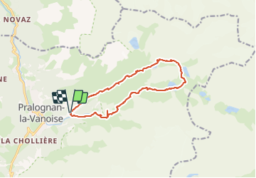

Length
14.2 km

Max alt
2517 m

Uphill gradient
914 m
Km-Effort
26 km

Min alt
1648 m

Downhill gradient
912 m
Boucle
Yes
Creation date :
2023-06-26 06:48:36.011
Updated on :
2023-06-26 14:26:52.53
6h52
Difficulty : Difficult

FREE GPS app for hiking
 SityTrail
IGN / Geographical institutes
SityTrail Plus
The world is yours!
About
Trail Walking of 14.2 km to be discovered at Auvergne-Rhône-Alpes, Savoy, Pralognan-la-Vanoise. This trail is proposed by labarone.
Description
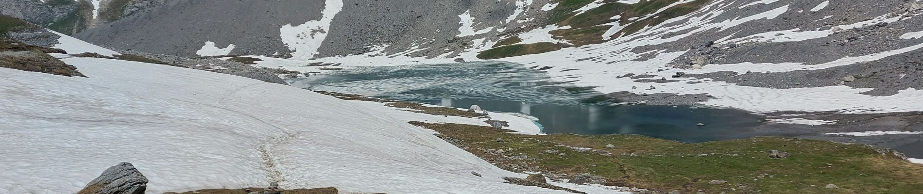
magnifique lacs et montagne
montée difficile
descente cool
marmottes et chamois
Photos


Positioning
Country:
France
Region :
Auvergne-Rhône-Alpes
Department/Province :
Savoy
Municipality :
Pralognan-la-Vanoise
Location:
Unknown
Start:(Dec)
Start:(UTM)
322710 ; 5027864 (32T) N.
Comments