


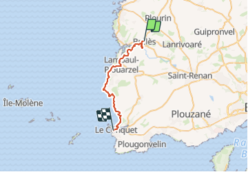
Le Conquet

thonyc
User GUIDE

Length
27 km

Max alt
57 m

Uphill gradient
379 m
Km-Effort
32 km

Min alt
0 m

Downhill gradient
399 m
Boucle
No
Creation date :
2023-06-27 06:15:22.942
Updated on :
2023-06-27 16:58:35.575
10h40
Difficulty : Difficult

FREE GPS app for hiking
 SityTrail
IGN / Geographical institutes
SityTrail Plus
The world is yours!
About
Trail Walking of 27 km to be discovered at Brittany, Finistère, Brélès. This trail is proposed by thonyc.
Positioning
Country:
France
Region :
Brittany
Department/Province :
Finistère
Municipality :
Brélès
Location:
Unknown
Start:(Dec)
Start:(UTM)
373346 ; 5370866 (30U) N.
Comments