


220629 jasserie de garnier

Julliengamo
User
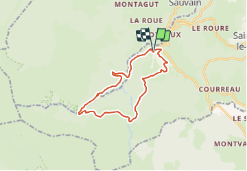

Length
13.1 km

Max alt
1362 m

Uphill gradient
517 m
Km-Effort
20 km

Min alt
877 m

Downhill gradient
514 m
Boucle
Yes
Creation date :
2023-06-29 07:36:40.188
Updated on :
2023-06-29 13:24:14.932
3h34
Difficulty : Very difficult

FREE GPS app for hiking
 SityTrail
IGN / Geographical institutes
SityTrail Plus
The world is yours!
About
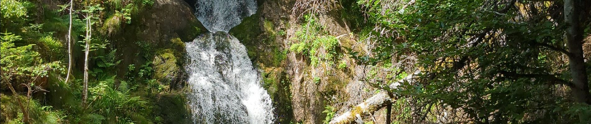
Trail Walking of 13.1 km to be discovered at Auvergne-Rhône-Alpes, Loire, Saint-Bonnet-le-Courreau. This trail is proposed by Julliengamo.
Photos

Positioning
Country:
France
Region :
Auvergne-Rhône-Alpes
Department/Province :
Loire
Municipality :
Saint-Bonnet-le-Courreau
Location:
Unknown
Start:(Dec)
Start:(UTM)
569387 ; 5056275 (31T) N.
Comments