


Le lac blanc

raygautier
User
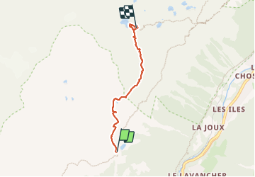

Length
4.3 km

Max alt
2365 m

Uphill gradient
499 m
Km-Effort
9.4 km

Min alt
1859 m

Downhill gradient
29 m
Boucle
No
Creation date :
2023-07-02 10:28:59.0
Updated on :
2023-07-03 15:08:48.919
4h51
Difficulty : Medium

FREE GPS app for hiking
 SityTrail
IGN / Geographical institutes
SityTrail Plus
The world is yours!
About
Trail Walking of 4.3 km to be discovered at Auvergne-Rhône-Alpes, Upper Savoy, Chamonix-Mont-Blanc. This trail is proposed by raygautier.
Positioning
Country:
France
Region :
Auvergne-Rhône-Alpes
Department/Province :
Upper Savoy
Municipality :
Chamonix-Mont-Blanc
Location:
Unknown
Start:(Dec)
Start:(UTM)
336272 ; 5091844 (32T) N.
Comments