Les Chemins d'Isabelle P2

CDSM 55
User

Length
34 km

Max alt
438 m

Uphill gradient
576 m
Km-Effort
42 km

Min alt
291 m

Downhill gradient
576 m
Boucle
Yes
Creation date :
2023-07-03 16:40:11.562
Updated on :
2023-07-03 16:45:23.479
2h54
Difficulty : Very difficult

FREE GPS app for hiking
 SityTrail
IGN / Geographical institutes
SityTrail Plus
The world is yours!
About
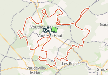
Trail Mountain bike of 34 km to be discovered at Grand Est, Meuse, Vouthon-Haut. This trail is proposed by CDSM 55.
Description
Plutôt pour costauds, avec quelques échappatoires possibles pour moins aguerris
Positioning
Country:
France
Region :
Grand Est
Department/Province :
Meuse
Municipality :
Vouthon-Haut
Location:
Unknown
Start:(Dec)
Start:(UTM)
693470 ; 5372517 (31U) N.
Comments