


2023-07-04_14h51m24_Mullerthal_Larochette_L1

Laurence Lallemand
User
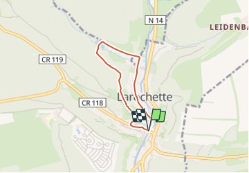

Length
2.2 km

Max alt
347 m

Uphill gradient
75 m
Km-Effort
3.3 km

Min alt
268 m

Downhill gradient
77 m
Boucle
Yes
Creation date :
2023-07-04 12:51:24.086
Updated on :
2023-07-12 19:29:10.22
44m
Difficulty : Easy

FREE GPS app for hiking
 SityTrail
IGN / Geographical institutes
SityTrail Plus
The world is yours!
About
Trail Walking of 2.2 km to be discovered at Unknown, Canton Mersch, Larochette. This trail is proposed by Laurence Lallemand.
Positioning
Country:
Luxembourg
Region :
Unknown
Department/Province :
Canton Mersch
Municipality :
Larochette
Location:
Unknown
Start:(Dec)
Start:(UTM)
299849 ; 5518348 (32U) N.
Comments