Saint Pierre de Courtille

Dupuybadonniere
User
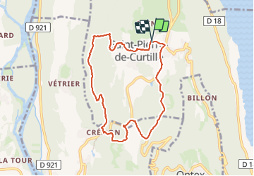

Length
8.2 km

Max alt
547 m

Uphill gradient
243 m
Km-Effort
11.4 km

Min alt
345 m

Downhill gradient
247 m
Boucle
Yes
Creation date :
2023-07-07 07:51:51.975
Updated on :
2023-07-07 10:42:37.767
2h03
Difficulty : Medium

FREE GPS app for hiking
 SityTrail
IGN / Geographical institutes
SityTrail Plus
The world is yours!
About
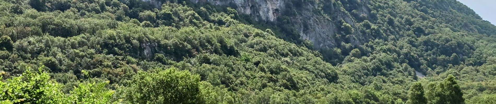
Trail Walking of 8.2 km to be discovered at Auvergne-Rhône-Alpes, Savoy, Saint-Pierre-de-Curtille. This trail is proposed by Dupuybadonniere.
Photos

Positioning
Country:
France
Region :
Auvergne-Rhône-Alpes
Department/Province :
Savoy
Municipality :
Saint-Pierre-de-Curtille
Location:
Unknown
Start:(Dec)
Start:(UTM)
718553 ; 5073093 (31T) N.
Comments