


2014-12-29 Rando Gif sur Yvette

jchezlemas
User
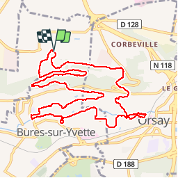

Length
13.1 km

Max alt
168 m

Uphill gradient
194 m
Km-Effort
15.7 km

Min alt
55 m

Downhill gradient
194 m
Boucle
Yes
Creation date :
2014-12-29 00:00:00.0
Updated on :
2014-12-29 00:00:00.0
3h25
Difficulty : Easy

FREE GPS app for hiking
 SityTrail
IGN / Geographical institutes
SityTrail Plus
The world is yours!
About
Trail Walking of 13.1 km to be discovered at Ile-de-France, Essonne, Gif-sur-Yvette. This trail is proposed by jchezlemas.
Positioning
Country:
France
Region :
Ile-de-France
Department/Province :
Essonne
Municipality :
Gif-sur-Yvette
Location:
Unknown
Start:(Dec)
Start:(UTM)
438412 ; 5395601 (31U) N.
Comments