


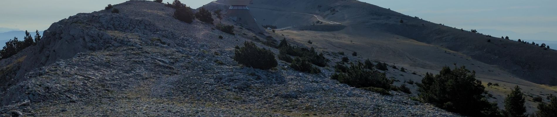
Mt Serein - Cachillan

MarcLEBARON
User
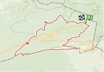

Length
12.1 km

Max alt
1821 m

Uphill gradient
616 m
Km-Effort
20 km

Min alt
1242 m

Downhill gradient
617 m
Boucle
Yes
Creation date :
2023-07-13 04:30:29.005
Updated on :
2023-12-02 15:37:06.76
4h16
Difficulty : Difficult

FREE GPS app for hiking
 SityTrail
IGN / Geographical institutes
SityTrail Plus
The world is yours!
About
Trail Walking of 12.1 km to be discovered at Provence-Alpes-Côte d'Azur, Vaucluse, Beaumont-du-Ventoux. This trail is proposed by MarcLEBARON.
Photos


Positioning
Country:
France
Region :
Provence-Alpes-Côte d'Azur
Department/Province :
Vaucluse
Municipality :
Beaumont-du-Ventoux
Location:
Unknown
Start:(Dec)
Start:(UTM)
681812 ; 4894921 (31T) N.
Comments