Nozeroy la source de l'Ain

grasgilbert
User
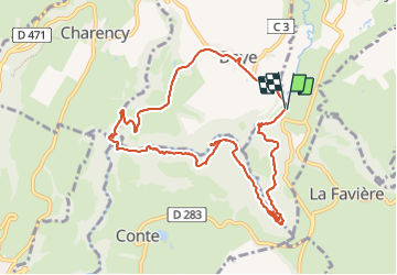

Length
10.8 km

Max alt
792 m

Uphill gradient
323 m
Km-Effort
15.1 km

Min alt
638 m

Downhill gradient
326 m
Boucle
Yes
Creation date :
2023-07-14 06:50:26.242
Updated on :
2023-07-17 17:34:04.38
3h26
Difficulty : Difficult

FREE GPS app for hiking
 SityTrail
IGN / Geographical institutes
SityTrail Plus
The world is yours!
About
Trail Walking of 10.8 km to be discovered at Bourgogne-Franche-Comté, Jura, Nozeroy. This trail is proposed by grasgilbert.
Description
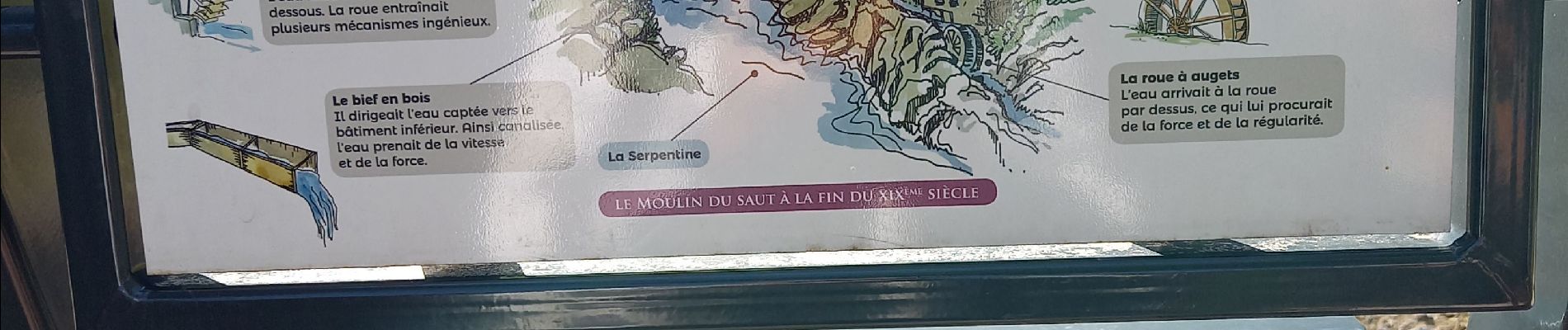
superbe randonnée difficulté moyenne à refaire au printemps après une semaine de pluie pour avoir plein d'eau casse-croûte sur la plage en dessous du pont de l'Ain
Photos


Positioning
Country:
France
Region :
Bourgogne-Franche-Comté
Department/Province :
Jura
Municipality :
Nozeroy
Location:
Unknown
Start:(Dec)
Start:(UTM)
272773 ; 5182982 (32T) N.
Comments