


Col et Pointe de la Sitre

ranchoup
User


5h14
Difficulty : Very difficult

FREE GPS app for hiking
 SityTrail
IGN / Geographical institutes
SityTrail Plus
The world is yours!
About
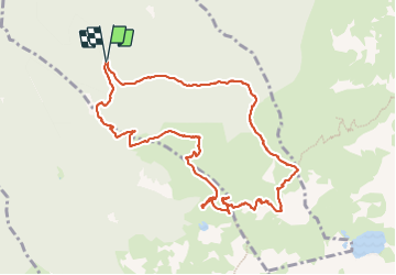
Trail Walking of 11.2 km to be discovered at Auvergne-Rhône-Alpes, Isère, Saint-Mury-Monteymond. This trail is proposed by ranchoup.
Description
A faire plutot dans le sens des aiguilles d'une montre, en partant de la Souille et en passant par le Habert du Mousset. La cote est raide entre Mousset et le col de la Sitre , à faire tranquillement dans un paysage très sauvage, le Pic de Belledonne et le refuge Jean Collet en arrières plans. On peut faire un plus en rejoignant la Pointe de la Sitre.
Très belle vue sur le lac de la Sitre ; on peut s'en rapprocher à la descente.
Photos


21 photos in total. Please click on a photo to see them all in the gallery.
Positioning
Comments