


Le p’tit nid

raygautier
User

Length
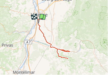
169 km

Max alt
669 m

Uphill gradient
1922 m
Km-Effort
195 km

Min alt
109 m

Downhill gradient
1922 m
Boucle
Yes
Creation date :
2023-07-16 16:06:00.0
Updated on :
2023-07-19 07:57:45.229
32h08
Difficulty : Very difficult

FREE GPS app for hiking
 SityTrail
IGN / Geographical institutes
SityTrail Plus
The world is yours!
About
Trail Walking of 169 km to be discovered at Auvergne-Rhône-Alpes, Drôme, Portes-lès-Valence. This trail is proposed by raygautier.
Positioning
Country:
France
Region :
Auvergne-Rhône-Alpes
Department/Province :
Drôme
Municipality :
Portes-lès-Valence
Location:
Unknown
Start:(Dec)
Start:(UTM)
648903 ; 4970989 (31T) N.
Comments