


Je jasse 2

raygautier
User
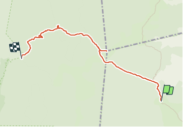

Length
6.6 km

Max alt
1618 m

Uphill gradient
64 m
Km-Effort
8.4 km

Min alt
1326 m

Downhill gradient
341 m
Boucle
No
Creation date :
2023-07-22 06:30:21.0
Updated on :
2023-07-22 10:11:11.758
3h22
Difficulty : Medium

FREE GPS app for hiking
 SityTrail
IGN / Geographical institutes
SityTrail Plus
The world is yours!
About
Trail Walking of 6.6 km to be discovered at Auvergne-Rhône-Alpes, Isère, Gresse-en-Vercors. This trail is proposed by raygautier.
Positioning
Country:
France
Region :
Auvergne-Rhône-Alpes
Department/Province :
Isère
Municipality :
Gresse-en-Vercors
Location:
Unknown
Start:(Dec)
Start:(UTM)
697501 ; 4976111 (31T) N.
Comments