


Verdon : Cadière de Brandis

manumax
User
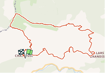

Length
17.2 km

Max alt
1725 m

Uphill gradient
1123 m
Km-Effort
32 km

Min alt
850 m

Downhill gradient
1122 m
Boucle
Yes
Creation date :
2016-08-22 00:00:00.0
Updated on :
2016-08-22 00:00:00.0
6h48
Difficulty : Medium

FREE GPS app for hiking
 SityTrail
IGN / Geographical institutes
SityTrail Plus
The world is yours!
About
Trail Walking of 17.2 km to be discovered at Provence-Alpes-Côte d'Azur, Alpes-de-Haute-Provence, Castellane. This trail is proposed by manumax.
Description
Cadière de Brandis31/12/2014
Positioning
Country:
France
Region :
Provence-Alpes-Côte d'Azur
Department/Province :
Alpes-de-Haute-Provence
Municipality :
Castellane
Location:
Unknown
Start:(Dec)
Start:(UTM)
292880 ; 4856858 (32T) N.
Comments