


Le chemin de ronde de Chaudin

mimimartine
User
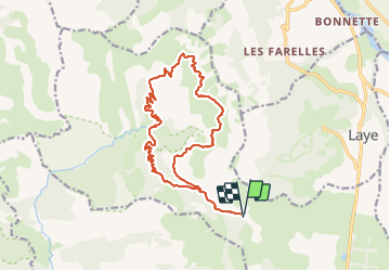

Length
18.7 km

Max alt
1785 m

Uphill gradient
757 m
Km-Effort
29 km

Min alt
1317 m

Downhill gradient
757 m
Boucle
Yes
Creation date :
2023-07-27 19:08:12.248
Updated on :
2023-07-27 19:09:58.465
0m
Difficulty : Very easy

FREE GPS app for hiking
 SityTrail
IGN / Geographical institutes
SityTrail Plus
The world is yours!
About
Trail On foot of 18.7 km to be discovered at Provence-Alpes-Côte d'Azur, Hautes-Alpes, Gap. This trail is proposed by mimimartine.
Positioning
Country:
France
Region :
Provence-Alpes-Côte d'Azur
Department/Province :
Hautes-Alpes
Municipality :
Gap
Location:
Gap
Start:(Dec)
Start:(UTM)
265811 ; 4945282 (32T) N.
Comments