


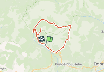
chorges réallon tour pic de serre

Titinechris
User

Length
33 km

Max alt
2702 m

Uphill gradient
2745 m
Km-Effort
69 km

Min alt
1274 m

Downhill gradient
2727 m
Boucle
Yes
Creation date :
2023-07-28 12:44:13.468
Updated on :
2023-07-28 12:49:30.383
15h43
Difficulty : Very difficult
0m
Difficulty : Very difficult

FREE GPS app for hiking
 SityTrail
IGN / Geographical institutes
SityTrail Plus
The world is yours!
About
Trail Walking of 33 km to be discovered at Provence-Alpes-Côte d'Azur, Hautes-Alpes, Réallon. This trail is proposed by Titinechris.
Positioning
Country:
France
Region :
Provence-Alpes-Côte d'Azur
Department/Province :
Hautes-Alpes
Municipality :
Réallon
Location:
Unknown
Start:(Dec)
Start:(UTM)
290848 ; 4941391 (32T) N.
Comments