


chorges-aiguilles de chabrières

Titinechris
User

Length
17.5 km

Max alt
2321 m

Uphill gradient
1036 m
Km-Effort
31 km

Min alt
1396 m

Downhill gradient
1039 m
Boucle
Yes
Creation date :
2023-07-28 13:03:25.891
Updated on :
2023-07-28 13:04:09.433
0m
Difficulty : Medium

FREE GPS app for hiking
 SityTrail
IGN / Geographical institutes
SityTrail Plus
The world is yours!
About
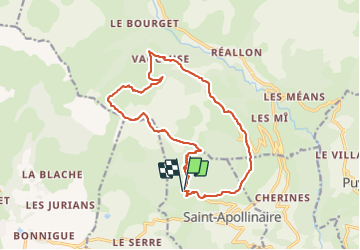
Trail Trail of 17.5 km to be discovered at Provence-Alpes-Côte d'Azur, Hautes-Alpes, Saint-Apollinaire. This trail is proposed by Titinechris.
Positioning
Country:
France
Region :
Provence-Alpes-Côte d'Azur
Department/Province :
Hautes-Alpes
Municipality :
Saint-Apollinaire
Location:
Unknown
Start:(Dec)
Start:(UTM)
289247 ; 4937726 (32T) N.
Comments