


Marcols les Eaux 18km

thonyc
User GUIDE
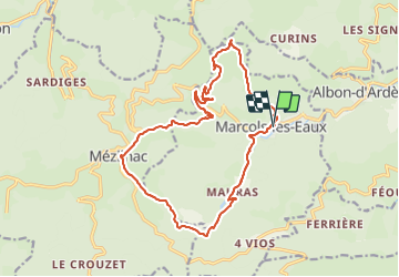

Length
18.2 km

Max alt
1178 m

Uphill gradient
778 m
Km-Effort
29 km

Min alt
726 m

Downhill gradient
779 m
Boucle
Yes
Creation date :
2023-08-05 07:25:10.847
Updated on :
2023-09-02 11:08:00.647
6h29
Difficulty : Very difficult

FREE GPS app for hiking
 SityTrail
IGN / Geographical institutes
SityTrail Plus
The world is yours!
About
Trail Walking of 18.2 km to be discovered at Auvergne-Rhône-Alpes, Ardèche, Marcols-les-Eaux. This trail is proposed by thonyc.
Description
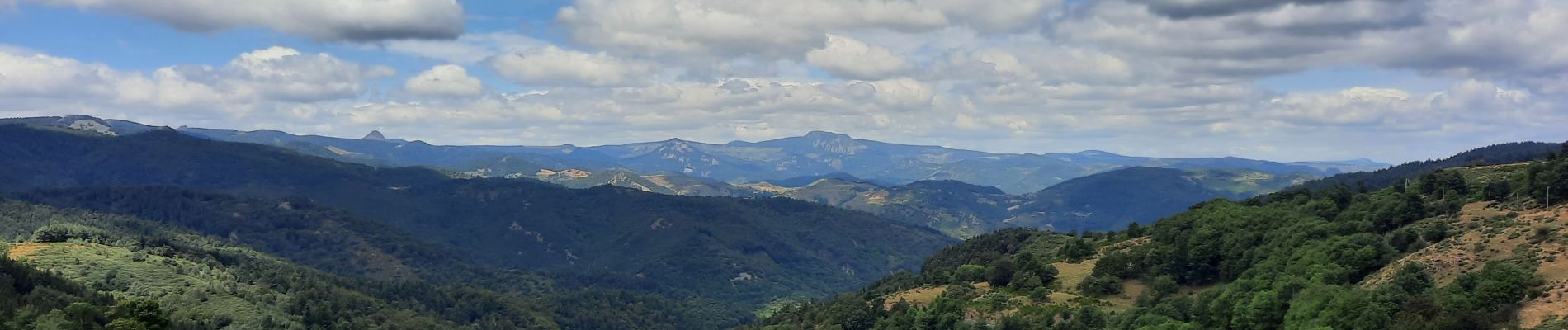
Le Rocher de Don et Mézilhac. Très belle rando avec de jolies panoramas à 360°.
Photos


Positioning
Country:
France
Region :
Auvergne-Rhône-Alpes
Department/Province :
Ardèche
Municipality :
Marcols-les-Eaux
Location:
Unknown
Start:(Dec)
Start:(UTM)
610648 ; 4963291 (31T) N.
Comments