


serreyrede à l aigoual par arboretum

labarone
User
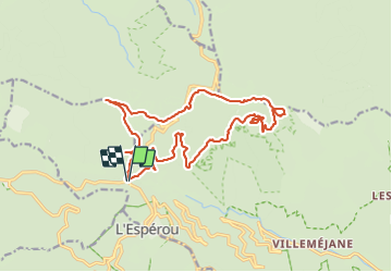

Length
20 km

Max alt
1569 m

Uphill gradient
608 m
Km-Effort
28 km

Min alt
1244 m

Downhill gradient
606 m
Boucle
Yes
Creation date :
2023-08-08 07:14:43.46
Updated on :
2023-08-08 14:29:38.107
7h13
Difficulty : Easy

FREE GPS app for hiking
 SityTrail
IGN / Geographical institutes
SityTrail Plus
The world is yours!
About
Trail Walking of 20 km to be discovered at Occitania, Gard, Val-d'Aigoual. This trail is proposed by labarone.
Description
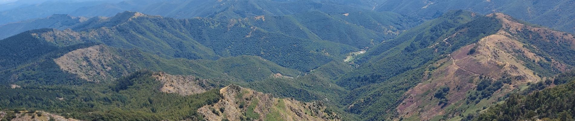
sympa belles vues
Photos


Positioning
Country:
France
Region :
Occitania
Department/Province :
Gard
Municipality :
Val-d'Aigoual
Location:
Valleraugue
Start:(Dec)
Start:(UTM)
543359 ; 4883457 (31T) N.
Comments