


Saint lambert

Houel
User
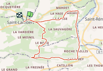

Length
10.3 km

Max alt
195 m

Uphill gradient
240 m
Km-Effort
13.5 km

Min alt
35 m

Downhill gradient
245 m
Boucle
Yes
Creation date :
2023-08-12 08:58:02.665
Updated on :
2023-08-12 12:41:44.943
2h55
Difficulty : Difficult

FREE GPS app for hiking
 SityTrail
IGN / Geographical institutes
SityTrail Plus
The world is yours!
About
Trail Walking of 10.3 km to be discovered at Normandy, Calvados, Cauville. This trail is proposed by Houel.
Positioning
Country:
France
Region :
Normandy
Department/Province :
Calvados
Municipality :
Cauville
Location:
Unknown
Start:(Dec)
Start:(UTM)
679843 ; 5423566 (30U) N.
Comments