


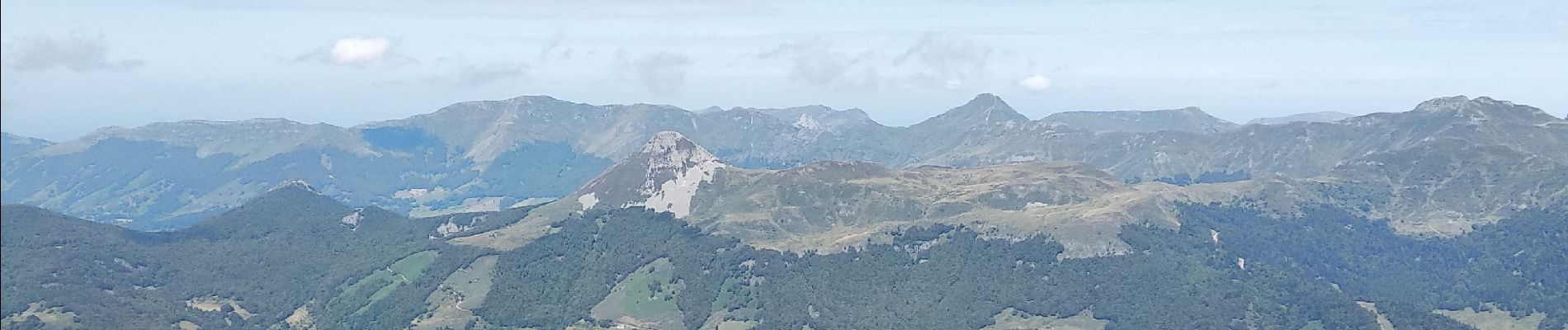
plomb du Cantal depuis Prat de bouc

alinetpierre
User
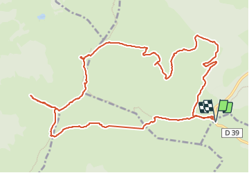

Length
14.7 km

Max alt
1839 m

Uphill gradient
602 m
Km-Effort
23 km

Min alt
1386 m

Downhill gradient
602 m
Boucle
Yes
Creation date :
2023-08-12 07:27:34.078
Updated on :
2023-08-12 14:37:11.393
4h10
Difficulty : Very difficult

FREE GPS app for hiking
 SityTrail
IGN / Geographical institutes
SityTrail Plus
The world is yours!
About
Trail Walking of 14.7 km to be discovered at Auvergne-Rhône-Alpes, Cantal, Paulhac. This trail is proposed by alinetpierre.
Description
retour par Pourtoule et col de la tombe du Père à travers les estives.
Photos


Positioning
Country:
France
Region :
Auvergne-Rhône-Alpes
Department/Province :
Cantal
Municipality :
Paulhac
Location:
Unknown
Start:(Dec)
Start:(UTM)
483773 ; 4988777 (31T) N.
Comments