


lac du serpent

Claude Luchetta
User

Length
12.8 km

Max alt
2457 m

Uphill gradient
586 m
Km-Effort
21 km

Min alt
1826 m

Downhill gradient
782 m
Boucle
No
Creation date :
2023-08-13 07:10:16.779
Updated on :
2023-08-13 11:37:21.522
4h26
Difficulty : Very difficult

FREE GPS app for hiking
 SityTrail
IGN / Geographical institutes
SityTrail Plus
The world is yours!
About
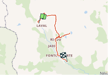
Trail Walking of 12.8 km to be discovered at Provence-Alpes-Côte d'Azur, Hautes-Alpes, Névache. This trail is proposed by Claude Luchetta.
Positioning
Country:
France
Region :
Provence-Alpes-Côte d'Azur
Department/Province :
Hautes-Alpes
Municipality :
Névache
Location:
Unknown
Start:(Dec)
Start:(UTM)
305176 ; 4992533 (32T) N.
Comments