


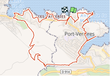
les batteries . collioure . fort sant elme . port vendres . cap gros

stef789
User GUIDE


3h42
Difficulty : Easy

FREE GPS app for hiking
 SityTrail
IGN / Geographical institutes
SityTrail Plus
The world is yours!
About
Trail Walking of 9.5 km to be discovered at Occitania, Pyrénées-Orientales, Port-Vendres. This trail is proposed by stef789.
Description
la rando fait 7 km et non 9.3 dus aux plantages de l appli : non je n ai jamais sauté dans le vide ni traversé le port à la nage ...
Photos


29 photos in total. Please click on a photo to see them all in the gallery.
Positioning
Comments