


Vienne cap manvieux

vienne14400
User
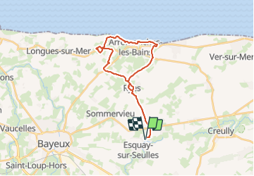

Length
26 km

Max alt
71 m

Uphill gradient
231 m
Km-Effort
29 km

Min alt
0 m

Downhill gradient
229 m
Boucle
Yes
Creation date :
2023-08-16 13:44:06.623
Updated on :
2023-08-16 16:04:38.25
2h20
Difficulty : Medium

FREE GPS app for hiking
 SityTrail
IGN / Geographical institutes
SityTrail Plus
The world is yours!
About
Trail Mountain bike of 26 km to be discovered at Normandy, Calvados, Vienne-en-Bessin. This trail is proposed by vienne14400.
Positioning
Country:
France
Region :
Normandy
Department/Province :
Calvados
Municipality :
Vienne-en-Bessin
Location:
Unknown
Start:(Dec)
Start:(UTM)
673644 ; 5461218 (30U) N.
Comments