


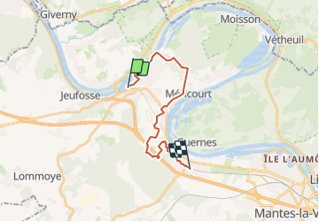
De Bonnières sur Seine à Rosny sur Seine

jpcccb
User

Length
16.5 km

Max alt
131 m

Uphill gradient
243 m
Km-Effort
19.7 km

Min alt
10 m

Downhill gradient
230 m
Boucle
No
Creation date :
2023-08-17 09:53:14.442
Updated on :
2023-08-17 10:05:00.659
4h28
Difficulty : Very difficult

FREE GPS app for hiking
 SityTrail
IGN / Geographical institutes
SityTrail Plus
The world is yours!
About
Trail Walking of 16.5 km to be discovered at Ile-de-France, Yvelines, Bonnières-sur-Seine. This trail is proposed by jpcccb.
Positioning
Country:
France
Region :
Ile-de-France
Department/Province :
Yvelines
Municipality :
Bonnières-sur-Seine
Location:
Unknown
Start:(Dec)
Start:(UTM)
396347 ; 5432716 (31U) N.
Comments