


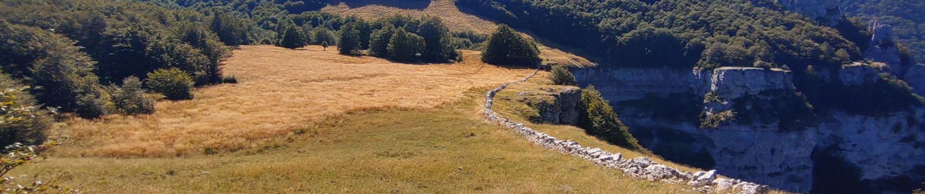
roc de Toulaud /tête de la Dame / mur des Chartreux

okfred26
User

Length
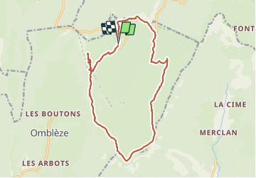
17.8 km

Max alt
1552 m

Uphill gradient
771 m
Km-Effort
28 km

Min alt
1102 m

Downhill gradient
768 m
Boucle
Yes
Creation date :
2023-08-15 07:10:56.688
Updated on :
2023-08-18 16:39:24.697
7h31
Difficulty : Very difficult

FREE GPS app for hiking
 SityTrail
IGN / Geographical institutes
SityTrail Plus
The world is yours!
About
Trail Walking of 17.8 km to be discovered at Auvergne-Rhône-Alpes, Drôme, Omblèze. This trail is proposed by okfred26.
Photos


Positioning
Country:
France
Region :
Auvergne-Rhône-Alpes
Department/Province :
Drôme
Municipality :
Omblèze
Location:
Unknown
Start:(Dec)
Start:(UTM)
677953 ; 4973571 (31T) N.
Comments