


2023-08-21_21h33m57_null-3.bin

jeanboulay
User
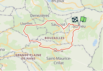

Length
14.7 km

Max alt
792 m

Uphill gradient
309 m
Km-Effort
18.9 km

Min alt
596 m

Downhill gradient
308 m
Boucle
Yes
Creation date :
2023-08-21 19:33:57.987
Updated on :
2023-08-21 19:33:58.329

FREE GPS app for hiking
 SityTrail
IGN / Geographical institutes
SityTrail Plus
The world is yours!
About
Trail of 14.7 km to be discovered at Bourgogne-Franche-Comté, Jura, Bonlieu. This trail is proposed by jeanboulay.
Positioning
Country:
France
Region :
Bourgogne-Franche-Comté
Department/Province :
Jura
Municipality :
Bonlieu
Location:
Unknown
Start:(Dec)
Start:(UTM)
718633 ; 5164737 (31T) N.
Comments