


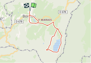
bonlieu lac

JL GUILLEMOTE
User

Length
8.2 km

Max alt
828 m

Uphill gradient
137 m
Km-Effort
10 km

Min alt
768 m

Downhill gradient
138 m
Boucle
Yes
Creation date :
2023-08-22 20:54:59.568
Updated on :
2023-08-22 20:55:03.678
2h16
Difficulty : Medium

FREE GPS app for hiking
 SityTrail
IGN / Geographical institutes
SityTrail Plus
The world is yours!
About
Trail Walking of 8.2 km to be discovered at Bourgogne-Franche-Comté, Jura, Bonlieu. This trail is proposed by JL GUILLEMOTE.
Positioning
Country:
France
Region :
Bourgogne-Franche-Comté
Department/Province :
Jura
Municipality :
Bonlieu
Location:
Unknown
Start:(Dec)
Start:(UTM)
718668 ; 5164985 (31T) N.
Comments