


Gorge de Franchard

lorenzot54
User
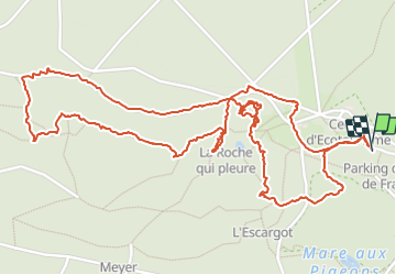

Length
4.1 km

Max alt
142 m

Uphill gradient
37 m
Km-Effort
4.6 km

Min alt
116 m

Downhill gradient
37 m
Boucle
Yes
Creation date :
2023-08-26 09:30:37.0
Updated on :
2023-08-26 13:10:55.931

FREE GPS app for hiking
 SityTrail
IGN / Geographical institutes
SityTrail Plus
The world is yours!
About
Trail of 4.1 km to be discovered at Ile-de-France, Seine-et-Marne, Fontainebleau. This trail is proposed by lorenzot54.
Positioning
Country:
France
Region :
Ile-de-France
Department/Province :
Seine-et-Marne
Municipality :
Fontainebleau
Location:
Unknown
Start:(Dec)
Start:(UTM)
472985 ; 5361790 (31U) N.
Comments