


Balade à Lavaissiére

alainjoseph6
User
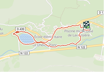

Length
2.4 km

Max alt
946 m

Uphill gradient
34 m
Km-Effort
2.8 km

Min alt
921 m

Downhill gradient
34 m
Boucle
Yes
Creation date :
2023-08-26 16:22:58.592
Updated on :
2023-08-26 17:26:31.593
1h02
Difficulty : Easy

FREE GPS app for hiking
 SityTrail
IGN / Geographical institutes
SityTrail Plus
The world is yours!
About
Trail Walking of 2.4 km to be discovered at Auvergne-Rhône-Alpes, Cantal, Laveissière. This trail is proposed by alainjoseph6.
Description
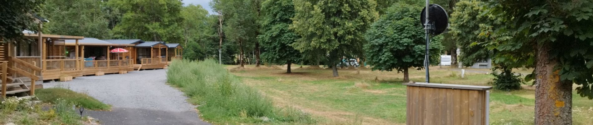
Une petite balade au départ du camping le Lavagnon en suivant le petit torrent vers le lac et retour par le village.
Photos


Positioning
Country:
France
Region :
Auvergne-Rhône-Alpes
Department/Province :
Cantal
Municipality :
Laveissière
Location:
Unknown
Start:(Dec)
Start:(UTM)
485150 ; 4995852 (31T) N.
Comments