


mittlach-steinwasen-rothenbachkopf-mittlach

lemuid
User
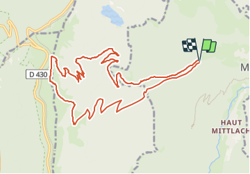

Length
12.2 km

Max alt
1297 m

Uphill gradient
687 m
Km-Effort
21 km

Min alt
601 m

Downhill gradient
689 m
Boucle
Yes
Creation date :
2023-08-30 10:04:52.766
Updated on :
2023-08-30 19:30:48.969
4h51
Difficulty : Medium

FREE GPS app for hiking
 SityTrail
IGN / Geographical institutes
SityTrail Plus
The world is yours!
About
Trail Walking of 12.2 km to be discovered at Grand Est, Haut-Rhin, Mittlach. This trail is proposed by lemuid.
Positioning
Country:
France
Region :
Grand Est
Department/Province :
Haut-Rhin
Municipality :
Mittlach
Location:
Unknown
Start:(Dec)
Start:(UTM)
352057 ; 5318718 (32U) N.
Comments