


la sambuy

mpstoop
User
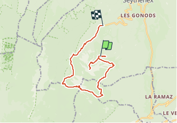

Length
15.1 km

Max alt
2156 m

Uphill gradient
933 m
Km-Effort
30 km

Min alt
1154 m

Downhill gradient
1602 m
Boucle
No
Creation date :
2023-09-02 06:12:53.208
Updated on :
2023-09-02 06:12:59.119
6h45
Difficulty : Very difficult

FREE GPS app for hiking
 SityTrail
IGN / Geographical institutes
SityTrail Plus
The world is yours!
About
Trail Walking of 15.1 km to be discovered at Auvergne-Rhône-Alpes, Upper Savoy, Faverges-Seythenex. This trail is proposed by mpstoop.
Positioning
Country:
France
Region :
Auvergne-Rhône-Alpes
Department/Province :
Upper Savoy
Municipality :
Faverges-Seythenex
Location:
Seythenex
Start:(Dec)
Start:(UTM)
287684 ; 5064164 (32T) N.
Comments